
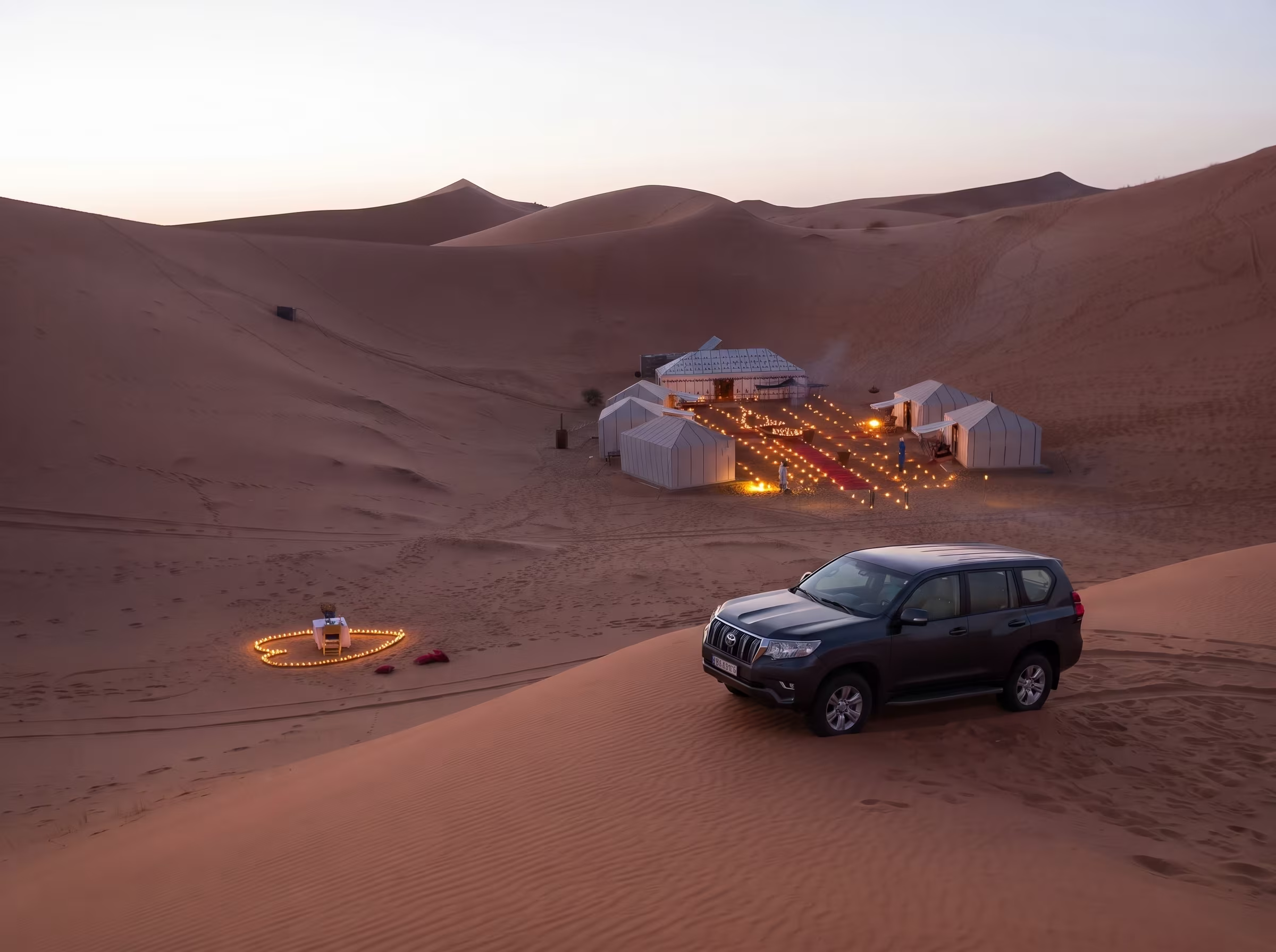
At Merzouga, you step out of the car onto a paved road and walk 200 metres to the dunes. At Chegaga, you leave the tarmac at Mhamid el Ghizlane, and you still have 60 kilometres of 4x4 track ahead of you (sandy wadis, stony plateaus, tracks that cross and all look alike) before you reach an erg 40 kilometres long, with almost no one in sight.
That's exactly why you need a real 4x4, a minimum of experience, and a little nerve. And it's also exactly why Chegaga is the Sahara that seasoned travellers come to Morocco to find.
Here is the complete 5-day itinerary in its scenic version: Marrakech → Aït Ben Haddou → Dadès Valley → Drâa Valley → Mhamid → Erg Chegaga. The route that is worth the journey as much as the destination.
Chegaga vs Merzouga: Which One to Choose?
First things first, let's clarify the choice. The two major ergs of the Moroccan Sahara — Erg Chebbi (Merzouga) and Erg Chegaga — aren't aimed at the same traveller.
- Erg Chebbi (Merzouga) is the Sahara that's accessible to everyone. The dunes are taller (up to 150 m), spectacular in photos, and reachable directly from a paved road. The tourist infrastructure there is massive: hotels, luxury camps, camel rides, organised excursions departing from Marrakech or Fès. It's perfect for discovering the desert in comfort mode.
- Erg Chegaga, on the other hand, is more discreet. The dunes are lower but more extensive (40 km long), the atmosphere is wilder, and above all access is only possible via 60 km of 4x4 track from Mhamid. There are neither tour buses nor hotels along the edge of the erg — only Berber bivouacs set up in the middle of the sand.
The right way to decide: Merzouga is the Sahara as an image. Chegaga is the Sahara as an experience. Both are worthwhile, but Chegaga requires having rented a real 4x4, having a bit of off-road driving experience, and accepting more demanding logistics in exchange for incomparable authenticity.
If you're still hesitating, the Merzouga itinerary is detailed in our complete 4x4 Merzouga guide.
The Itinerary at a Glance
- Total distance: about 1,100 km on a scenic loop
- Recommended duration: 5 days / 4 nights
- Best season: October to March (see our seasons guide)
- Vehicle: a 4x4 is essential, ideally a model suited to sand
- Difficulty: intermediate (road) to experienced (final track to Chegaga)
- Stages: Marrakech → Aït Ben Haddou → Dadès Valley → Drâa Valley / Mhamid → Erg Chegaga → return via Foum Zguid (loop) or Mhamid (direct).
Day 1: Marrakech → Aït Ben Haddou (200 km, ~4h drive)
Early start from Marrakech. The N9 climbs toward the Tizi n'Tichka, the legendary High Atlas pass at 2,260 metres. Allow 2 hours of winding ascent, then 1 hour of descent toward Ouarzazate. The panorama from the pass is worth a stop, as it marks the gateway to Morocco's great south.
On the way down, take the turn-off toward Aït Ben Haddou (30 km from Ouarzazate). The UNESCO-listed ksar, famous for its Game of Thrones and Gladiator filming, is best visited in late afternoon, once the tour buses have left and the golden light strikes the ochre earthen façades.
Park at the bottom of the village and walk up via the footbridge over the river, then climb to the fortified granary at the very top, from which you get one of the finest views in Morocco.
Overnight in a guesthouse facing the ksar (300–600 MAD depending on comfort). This is the "warm-up" stage: paved road, panoramas, first contact with the earthen architecture of the south. The 4x4 isn't really needed yet, but that's about to change.
For the full details of this first section, see our Marrakech → Ouarzazate 4x4 road trip guide.
Day 2: Aït Ben Haddou → Dadès Valley (200 km, day of exploration)
Head east again. The N10 runs along what's known as the Road of a Thousand Kasbahs: Skoura and its historic palm grove (Kasbah Amerhidil is worth a detour), then El Kelaâ M'Gouna at the heart of the Valley of the Roses. If you travel in April–May, the distillation of the Damask rose gives rise to a festival there. The rest of the year, several distilleries remain open to visitors.
Arrival in Boumalne Dadès in early afternoon. The day's real wonder begins here: head up the Dadès Gorges toward the north. The road, narrow and winding, follows the river between rock walls sculpted by erosion. The famous series of hairpin bends about 25 km above Boumalne is one of the most recognisable photo spots in Morocco.
Continue if possible as far as the "monkey fingers", spectacular rock formations about 30 km higher up. Then head back to Boumalne or spend the night in an inn on the gorge wall. Several establishments have terraces suspended above the river. It's the most contemplative day of the trip.
Day 3: Dadès → Drâa Valley → Mhamid (350 km, long day)
The most demanding day in terms of distance, but also the one that truly brings you to the gates of the desert. Head back toward Ouarzazate, then descend south on the N9. After the Tizi n'Tinifift pass, you enter the Drâa Valley, home to the longest palm grove in North Africa, stretching nearly 200 kilometres.
Possible stops along the way: Agdz and the kasbahs of Tamnougalt (one of the oldest in the region), then Zagora, nicknamed "Timbuktu 52 days" in reference to the old caravan sign still visible at the edge of town. It's also your last serious logistics stop: fill up, top up your water reserves, withdraw cash.
After Zagora, the palm grove grows denser and the road wilder. Tinfou and its small dunes serve as a visual appetiser. Arrival in Mhamid el Ghizlane at the end of the day, the last town before the great desert.
Overnight in Mhamid at an inn or a bivouac at the edge of the sand. Check your 4x4 that evening: tyre pressure (to be deflated to about 1.5 bar for the next day's track), water and fuel levels, luggage security. The tarmac stops here.
Day 4: Mhamid → Erg Chegaga (60 km of track, 2 to 3h of driving)
This is where your 4x4 truly comes into its own. The 60 kilometres between Mhamid and Erg Chegaga are a real desert stretch: crossings of sandy wadis, stony hammada plateaus, soft-sand passages, and sometimes hazy navigation because the tracks cross and all look alike.
Three main track routes link Mhamid to Chegaga, more or less technical depending on conditions. None is officially waymarked. Don't set off without GPS (load the GPS tracks in advance — Wikiloc, OsmAnd, and Gaia GPS are among the go-to apps), without a water reserve (30 litres per vehicle minimum), and without knowing the basics of getting unstuck. Sand-driving technique differs radically from track driving: lowered tyre pressure, constant speed, gearing kept just right. The fundamentals are detailed in our 4x4 driving guide for Morocco.
Arrival at Erg Chegaga in late morning if you leave early. The first sandy reliefs appear, then the erg unfolds: 40 kilometres of unbroken dunes, with no sign of civilisation on the horizon. Several bivouac camps are set up along the edge of the erg. The options range from the most rustic accommodation (€20 to €30 per person, dinner included) to the most luxurious camps (from €100), with high-end Berber tents and full sanitary facilities.
After settling in, don't miss the sunset from the top of a dune. Allow 30–45 minutes to climb through the soft sand. At the top, the reward is a 360° view over the erg, bathed in a light that alone justifies the whole trip.
Night under the stars. With no light pollution for hundreds of kilometres around, the sky over Chegaga is one of the purest in Morocco. To set off truly equipped, see our 4x4s fitted out for Sahara camping.
Day 5: The Return — Loop or Direct?
You have two options for the return, and the choice radically changes the final experience.
Option A: The Foum Zguid loop (recommended if an extra day is possible). This is the real distinctive feature of Chegaga vs Merzouga: you can exit to the west by following the track toward Foum Zguid (~3 hours of demanding but sublime desert driving, over terrain that gradually changes from soft sand to rocky plateaus). From Foum Zguid, a paved road leads to Tata or directly toward Taroudant, then Marrakech via Agadir or via the Anti-Atlas passes. Allow an extra day and a half, but you complete a route without passing through the same place twice.
Option B: Direct return via Mhamid. Take the track back toward Mhamid (the same 60 km, in reverse), then Zagora, Ouarzazate, Marrakech. It's a very long day of driving. Reckon on 8 to 10 hours of cumulative driving. Doable, but exhausting after 4 intense days.
If your schedule allows, choose Option A without hesitation. It's what turns a raid into a true tour of southern Morocco. It's also an experience you simply cannot have at Merzouga.
Field Tips Specific to Chegaga
Five critical points that few guides mention and that make all the difference on this itinerary:
- Never set off alone from Mhamid without GPS and downloaded tracks: The phone network disappears the moment you leave town. A single wrong turn can take you 20 km away from your destination. It can also lead you into a totally isolated area where no vehicle passes. Wikiloc and OsmAnd with offline maps are the bare minimum.
- Fill up in Zagora and top up in Mhamid: Mhamid has a petrol station, but it can be out of fuel. Set off with a full tank plus, if possible, a 20 L jerrycan. Fuel consumption rises sharply in the sand.
- Plan for a minimum of 30 litres of water per vehicle: Not only for drinking, but also for possibly cooling the vehicle and for your safety in case of a breakdown. It's an unbreakable rule in the Sahara.
- Bring recovery boards and a compressor: You'll be driving at about 1.5 bar in the sand (instead of 2.5 bar on the road); a portable compressor is essential for re-inflating at the end of the track. Recovery boards (sand tracks) save you from waiting 4 hours for the next car if you get stuck.
- Satellite phone or PLB recommended for self-sufficient groups: You'll be in a total dead zone for 24 to 48 hours. If you travel alone or in a small group without a guide, a satellite emergency device can save a situation.


